 Kristen Williams
When a G3 geomagnetic storm hit Earth on July 4, 2026 — two full levels stronger than NOAA's initial G1 forecast — northern lights blazed across 30 US states, reaching as far south as New Mexico and northern California. Millions of Americans stepped outside to photograph the spectacle. What far fewer noticed: their GPS apps had quietly drifted off course by dozens of meters, Starlink connections flickered across the northern states, and amateur radio operators from Montana to Minnesota lost critical HF frequencies for hours at a stretch.
The Question Millions Are Googling After July's Solar Storms
Multiple geomagnetic storm watches have been issued throughout July 2026 — including a G4 "severe" event in late July that drove auroras potentially as far south as Alabama — and the pattern is accelerating. With northern lights alerts arriving nearly every week, Americans are asking a practical question that electronics technicians and IT specialists are fielding more frequently this summer: what is the solar storm actually doing to my devices, and when is the disruption serious enough to call an expert?
The answer depends heavily on which class of device you're using and how you depend on it. For most households, the risk during a G3 event is manageable and largely invisible. For professionals relying on GPS-guided or satellite-connected equipment, July 2026 has already delivered expensive, preventable disruptions.
How a G3 Geomagnetic Storm Disrupts Your Electronics
Geomagnetic storms occur when the sun ejects a coronal mass ejection (CME) — a massive burst of magnetized plasma — that collides with Earth's magnetic field. The resulting disturbance produces two distinct threats to technology: geomagnetically induced currents (GICs), which flow through long conductive infrastructure, and ionospheric disturbances, which degrade the radio signals that GPS satellites use to communicate with receivers on the ground.
According to NOAA's Space Weather Prediction Center, a G3-class storm produces these documented, measurable effects on technology:
- GPS accuracy degradation of 10–50 meters: High-precision applications — including aviation instrument approaches, construction site surveying, real-time kinematic (RTK) agriculture, and drone navigation — can exceed safety tolerances entirely.
- High-frequency (HF) radio blackouts: Emergency services, maritime, and aviation communications on HF bands can lose signal for 1–6 hours during peak storm intensity.
- Satellite internet degradation: Satellite broadband users in northern states reported significant throughput drops during the July 4 event — a consequence of increased ionospheric scintillation affecting low-Earth orbit signal paths.
- Transmission line stress: Utilities in the northern US monitor geomagnetically induced currents in long-distance lines during G3+ events; consumer-level power surge risk is low but not zero for equipment connected to external antennas.
The July 4 event carried a specific warning for the future: NOAA's forecast missed the actual storm intensity by two full classification levels — from G1 to G3 — in real time. That compressed timeline means the warning window available to businesses and professionals can be measured in hours, not days.
If You Have a GPS-Dependent Business in the Northern US
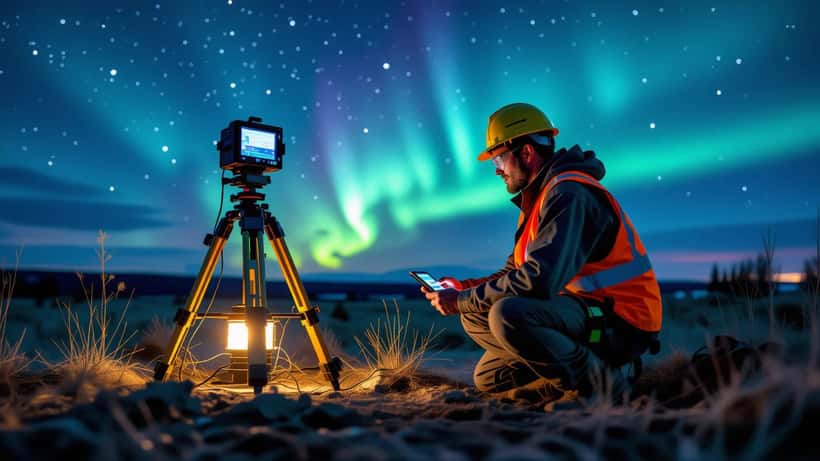
Take the case of a general contractor based in Billings, Montana — a city that saw visible auroras on at least three separate nights in July 2026. His crew uses a real-time kinematic (RTK) GPS system for land surveying and site layout, with positioning accuracy requirements under 2 centimeters.
During the G3 storm on July 4, RTK GPS systems across northern US states lost their ionospheric fix for approximately 3–6 hours, according to accounts from GNSS equipment operators in agriculture and surveying communities. For a crew billing $12,000 per day, a 4-hour outage represents roughly $6,000 in delayed or wasted billable time — with no standard business insurance coverage, since geomagnetic disruption falls under acts of nature.
The if/then logic scales with storm severity:
- If the Kp index climbs above 5 (G1 storm) → RTK GPS accuracy degrades; surveyors and precision farmers should expect increased error bars and plan re-verification steps
- If Kp exceeds 7 (G3 storm, as on July 4, 2026) → RTK systems in northern states likely lose fix entirely; optical total station or ground control points are the backup
- If Kp hits 8–9 (G4–G5, as occurred in late July 2026) → satellite internet outage probable; aviation GPS-dependent approaches affected; legally permitted drone operations using GPS flight controllers must ground
What many contractors, farmers, and logistics operators don't know is that their GNSS hardware may already include ionospheric correction models — specifically the US SBAS/WAAS system — that significantly reduce storm-period errors. A consultation with an electronics or IT specialist can determine whether your existing gear is already utilizing those corrections, identify whether a dual-frequency receiver upgrade is cost-justified given your storm exposure, and establish a documented backup workflow before the next event.
Given the current solar cycle's track record — Solar Cycle 25 has consistently exceeded NOAA intensity forecasts since 2024 — the next significant event is measured in days, not months.
Who Needs to Worry and Who Is Basically Fine
For the average American household, a G3 storm is an extraordinary light show and a mild inconvenience at most:
Largely unaffected:
- Consumer smartphones and tablets (assisted GPS and cellular positioning tolerate 10–30 meter errors without any noticeable navigation impact)
- Home Wi-Fi and cable internet (fully ground-based, unaffected by ionospheric conditions)
- Wired appliances and smart home devices not relying on external antennas
Moderately affected during G3+ events:
- Car navigation systems with cellular-assisted GPS (may drift 15–30 meters — usually harmless, occasionally disorienting on complex highway interchanges)
- Starlink and HughesNet subscribers in northern states (throughput drops, increased latency during peak storm hours)
- Amateur radio operators on 10m, 15m, and 20m HF bands (signal propagation disrupted for hours)
Significantly affected in professional use:
- Survey-grade GNSS receivers (can lose positioning fix entirely for several hours)
- Agricultural auto-steer and precision planting equipment
- Drone operations using GPS-dependent flight controllers (safety and legal restrictions apply during active geomagnetic storms)
- Emergency response and aviation HF communications networks
What to Do Before the Next Northern Lights Alert
The sun fired off 10 separate solar flares in a single 24-hour window during late June 2026, with multiple Earth-directed CMEs following in quick succession. The July 4 G3 storm beat its preliminary forecast by two levels. A G4 event arrived in late July. This pattern — frequent, underforecast, and arriving with compressed lead times — is consistent with Solar Cycle 25 behavior, which has outperformed NOAA projections repeatedly over the past two years.
Here is what professionals and informed households should do now:
1. Set up real-time NOAA alerts. The NOAA Space Weather Prediction Center at swpc.noaa.gov offers free email and text alerts tied to the Kp index — the 0-to-9 scale that measures geomagnetic storm intensity in real time. A Kp of 5 signals a G1 storm; Kp of 7 means G3; Kp of 8 means a G4 event of the type seen in late July. Knowing the Kp before your workday starts costs nothing.
2. Audit your GPS equipment's ionospheric tolerance. Professional GNSS datasheets specify expected accuracy under ionospheric stress conditions. Consumer GPS products typically don't. If you're running a business that depends on positioning accuracy, an electronics technician can review your equipment specs and identify whether SBAS/WAAS or dual-frequency correction is already active — or should be.
3. Consult a specialist before the next storm. An IT or electronics expert familiar with GNSS systems can map your storm exposure, recommend hardware upgrades or software configuration changes, and design a documented backup procedure for storm days. A single consultation — typically under two hours — can prevent the kind of $5,000–$10,000 disruption that contractors and agricultural operators have already reported this summer.
4. Protect antenna-connected equipment. Long external antenna runs and satellite dish installations can conduct geomagnetically induced currents during severe storms. A licensed electronics technician can evaluate whether surge isolation is warranted for your setup.
The northern lights have lit up US skies more frequently in 2026 than at any point in the past two decades, and the solar maximum means that pattern will continue well into late 2026. Whether the next aurora is a memorable spectacle or an operational setback depends on one question: do you know what your systems can handle before the Kp index climbs?
Disclaimer: This article is for informational purposes only and does not constitute technical or engineering advice. Consult a qualified electronics or IT professional for device-specific recommendations.